XI JINPING COMES TO AMDO QINGHAI
Xi Jinping’s recent tour of inspection of Qinghai province suggests all is well in the northern half of the Tibetan Plateau, which, in China’s usage has become hyphenated, as the Qinghai-Tibet Plateau, or QTP.

Although the Tibetan Plateau is one unit, in any sense –geographically, tectonically, altitudinally, culturally, linguistically, religiously- this split has enabled China to pursue very different strategies in northern and southern Tibet.
Most media coverage focuses on southern Tibet, which China calls Tibet Autonomous Region, which in area and population is only half of Tibet. Qinghai (Amdo in Tibetan) was an invention of the Manchu Qing conquerors of China, who wanted to separate the Mongols from the Tibetans by inserting, between them, a political fiction of Han Chinese control which, almost a century ago was declared to be a province in its own right.
Other than keeping the Mongols and Tibetans from being too close, Qinghai had little use for China, being remote, cold and much of it arid. In 1949 the population of the capital, Xining, was no more than 70,000, a mix of poor Muslim Chinese, Han peasant immigrants and on the upper slopes, Tibetans.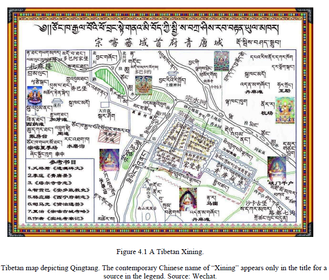
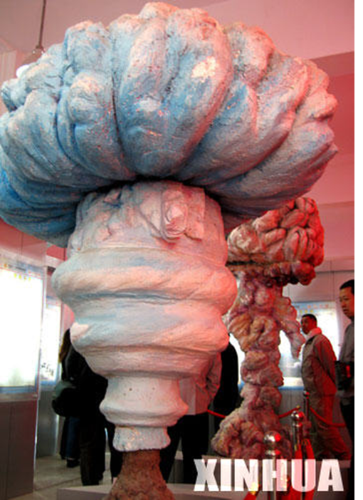
Revolutionary China had big plans to make the “waste land” of Qinghai productive. The blue lake for which Qinghai is named, in Chinese, Tibetan and Mongolian, became the location for China’s secret military industrialisation, site for developing and testing nuclear submarines and nuclear missiles, in a lake as distant from the prowling US Navy (and Soviet revisionists) as possible.
Beyond the lake, vast pasture lands stretched, populated thinly by mobile Tibetan pastoralist and their herds of yaks, sheep and goats. Surely, the planners in Beijing thought, they could be made more productive. The first step was to populate.
Geographer Andrew Grant says: “Starting in 1956, when the PRC launched its first rustication (Ch. xiafang) campaign, inland migrants were continuously sent to or encouraged to settle frontier regions. The goals of the migrants were often land reclamation. Locals rejected the Han migrants’ entrance into the region, and the migrants, likewise, rejected the local landscape and yearned to return home. One related policy was a program that encouraged young Chinese to join military-style teams (Ch. qingnian zhiyuan kenhuang dui) to open land to agriculture in Qinghai Province. These teams toiled to increase agricultural production in the arid Plateau climate, where they filled roles that had been held by prisoners and state workers. Grossly misjudging the agricultural potential of the land and sensitivity of the environment, the projects were largely abandoned and many of the youth fled the region.”[1]
Population transfer worked in many other areas into which Han China had expended, and could be expected to work in frigid Qinghai too. University of Toronto political scientist Isabelle Côté says: “Rich in natural resources, China’s frontier regions have also attracted several million spontaneous and organized migrants over the years. With barely seven people per square kilometre, Qinghai has one of the lowest population densities in China. For this reason, the idea to increase Qinghai’s population to about ten million with the help of internal migrants from the eastern province has grown in popularity since the 1950s. The subsequent waves of organized and spontaneous migrants have drastically altered the composition of the provincial population.”[2]
The rhetoric accompanying these urgings to populate the far west initially emphasized the heroic revolutionary duty to liberate backward areas from feudalism. Historian Greg Rohlf reminds us: “the communist government explicitly recruited women for relocation to border and remote areas. In their propaganda, they promoted the idea that women’s movement to border areas was to be a liberator process. Border areas were not weighed down as much by the burdens of traditional, feudal customs that oppressed women in China’s villages and cities. Women would excel in border areas because socialism and civilization could be constructed in one gigantic step from the unrefined but “sleeping” grasslands or forests of the borderlands. Party-run newspapers, magazines, and books gave high-profile coverage to women in their publications and maintained the Party line that women were racing to equality in the special conditions of border regions. Yet, the evidence also shows that women were moved to border regions to serve in their traditional roles as wives and mothers.”[3]
These efforts tried to motivate voluntary Han settlement of an area known throughout China not only for its challenging climate but as a place of exile for involuntary settlers, a Chinese Siberia, a prison with few walls as there was nowhere survivable escapees could flee to. Revolutionary enthusiasm, despite energetic propaganda, largely failed to repopulate Qinghai with Han, with two exceptions. China tried large-scale state farms, far larger than anything traditional, with workers highly regimented, copying the military model used to settle Han in Xinjiang, further north.
THE HEAVY INDUSTRIAL HUB OF THE TIBETAN PLATEAU
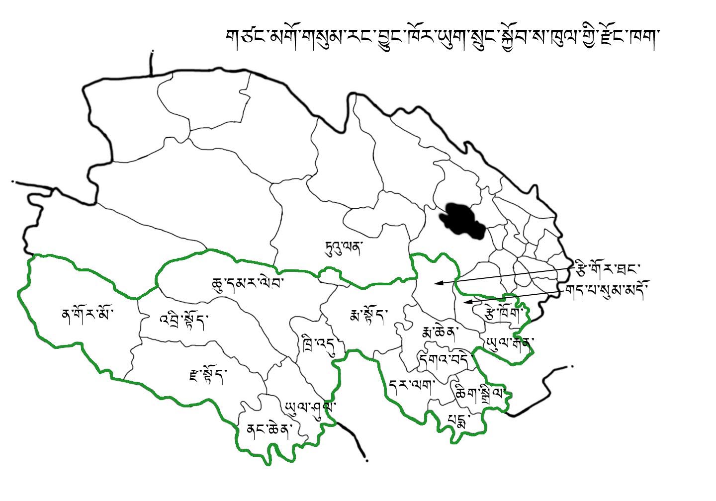
The two Qinghai areas where an influx did swell population are, not coincidentally, the two lowest in altitude on the Tibetan Plateau: the farmland surrounding the capital Xining, and the arid Tsaidam Basin (in Chinese: Qaidam or Qaidamu), far to the west. In the counties surrounding Xining, Chinese Muslims needed few inducements to resettle, as they were leaving the heavily eroded, over-used loess plateau to the east, escaping deep poverty.
The Tsaidam Basin was a different story. It had oil, salt lakes rich in the salts of useful elements: potash for fertiliser, magnesium for metal manufacturing, lithium salts for many industrial uses, and common sodium salt, an ingredient in making plastics, especially polyvinyl chloride, and for making urea chemical fertiliser. Later gas was discovered, and piped directly to Chinese markets. The Tsaidam Basin, a bit below 3000 m above sea level –low compared to the rest of Tibet- was ripe for full-scale industrialisation. Oil has been extracted at a steady rate of two million tons a year, for decades. Salt production is close to 10 million tons a year. The small town of Gormo was transformed into an industrial hub, with petrochemical refineries and crackers, lead and zinc smelters. According to the official 2015 Qinghai Statistical Yearbook, the Tsaidam Basin (Haixi Autonomous Prefecture, in Tibetan: Tsonub) now produces 13.9 m tons of coal a year, 2.2 m tons of “crude petroleum oil”, 493,000 tons of refined gasoline, 620,000 tons of diesel, 6890 million cubic metres of natural gas, 8.3 million tons of potash fertiliser, 4.8 m tons of urea fertiliser, and 6.5 tons of gold, making Tsaidam by far the most heavily industrialised area, and most profitable, not only in Qinghai but anywhere on the Tibetan Plateau.[4] Coal-fired power stations not only supply the heavy industries in Gormo but also distant Lhasa, via an ultra-high voltage power grid that transmits electricity along the same route as the railway and highway to Lhasa, also shared by an oil pipeline from Gormo. The Tsaidam Basin is the engine of the Qinghai economy, and the only portion of the Tibetan Plateau where “Chinese characteristics” have been successfully implanted.
Scientific efforts began early, in areas where oil naturally seeps to the surface. The quarterly Journal of Salt Lake Research began publishing in 1972, insulated from the raging Cultural Revolution.
Scientific teams are now hopeful of making a major uranium find in the Tsaidam Basin.[5] Uranium, needed for the dramatic expansion in nuclear power now under construction across China, has been found elsewhere on the Tibetan Plateau, including the lithium-rich Zhabuye (in Tibetan Drangyer Tsaka) salt lake of far western upper Tibet. [6] Uranium has also been found in the medicinal hot springs of Dzoge, at Jianzha, well east of Gormo.[7] If these deposits proceed to extraction, they may be processed in Gormo.
So industrialised is the Tsaidam Basin, it may be linked by a rail connection with the even bigger heavy industrial hub of Xinjiang, as well as by the pipelines that now send gas and oil from both, to inland Chinese refineries.
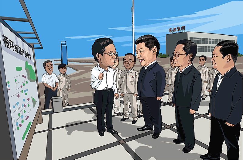
In 2016 it was to this area that supreme leader Xi Jinping came, on inspection tour, pronouncing everything he saw a success. Not only is heavy industry highly concentrated in the Gormo enclave, so too is the population of Tibetan pastoralists displaced by the official policy of closing pastures “to grow more grass”, or tuimu huancao. Xi Jinping was conveniently able to visit former pastoralists on the outskirts of Gormo (Golmud in Chinese), who are unable to move ahead, into urban employment, as they lack literacy in Chinese, mandatory in heavy industry; nor move back to their distant pastures in Mato county (Maduo in Chinese), source of the Yellow River, as its Tibetan name denotes.
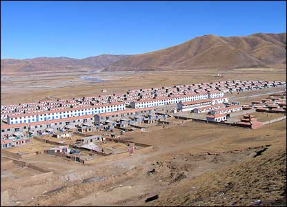 Despite their bleak prospects, in regimented lines of concrete slab blocks along either side of the highway leading into Gormo, Xi Jinping declared himself satisfied that these “ecological migrants” are doing well, the “fragile” area from which they were removed is now well protected, and thus he had “inspected ecological projects that have benefited ethnic minority communities.”
THE TIBETAN LOWLANDS OF TSOSHAR
Apart from inspecting the many heavy industries of the Tsaidam Basin, and the capital, Xining, now a city of two million people with phalanxes of apartment tower blocks, often empty shells awaiting settlers, Xi Jinping’s other destination in Qinghai was to Haidong Municipality (Tsoshar in Tibetan). Until 2013 Haidong, the easternmost part of Qinghai, between the cities of Xining and Lanzhou, low enough in altitude to support intensive irrigated farming, was not a municipality but one of the six prefectures of Qinghai. Its upgrading from prefecture to municipality reflects the success of population transfer, with immigrants occupying all the lower slopes, leaving Tibetans in the surrounding mountains, on eroding higher slopes. In 2014 the total population of this sprawling municipality was 1.7 million, just short of 30 per cent of the entire provincial population. Much of Haidong is below 2000 m altitude, only half the elevation of the high plateau stretching across Tibet.
So overpopulated is this immigrant area, denuding forests and soils, that many were reduced to poverty and even immiserisation, whereupon, in the 1990s China’s government sought to relocate a substantial number even further west, to the Tsaidam Basin. This Ninth Five-Year Plan project was accepted by the World Bank, which agreed to finance the core infrastructure, a dam to intercept the one intermittent river of this arid area, to impound sufficient water for traditional intensive small plot irrigated crop production by up to 60,000 resettlers. The “move in” area (to use a World Bank term directly translated from Chinese) was Xiangride (Panchen Zhingde in Tibetan), a traditional Tibetan and Mongolian pasture, with its own camel market, and camels used even for ploughing. When Tibetans protested that the World Bank should not abet China’s centralised population transfer engineering, the project became controversial.
The “move out” area of emigration was almost entirely in what has become Haidong Municipality. One consequence of the World Bank’s involvement is detailed documentation of both the “move out” and “move in” areas. The World Bank paints a bleak picture of the “move out” areas of Haidong in the late 1990s: “crop yields are low due to poor soil quality, low rainfall, recurrent drought and undeveloped farming techniques. There appear to be limited and possibly even no environmentally sustainable development options available in those areas.” The Tibetans, on the higher slopes, were especially poor. Following China’s state gaze perspective, the World Bank blames this on overgrazing: “Increasing cultivation and grazing pressures in mountainous areas are having devastating ecological impacts.”
However, the World Bank’s proposed solution, of moving 60,000 people to resettle in the Tsaidam Basin was not supported by the Tibetans and Mongols of the Tsaidam, and ultimately the World Bank withdrew its proposed loan, leaving China to proceed with a smaller scale project, relocating 20,000 people.
The World Bank withdrew after its Inspection Panel did its own on the ground investigation, reporting, in 2000, that the compliance of the “move out” population with voluntarily relocating was partly due to the picture they had been given of a fertile, irrigated “move in” area with schools, hospitals and electricity. “Most were not informed, however, of the desert climate, poor soils, danger of salinization, and the long start-up time needed before farms would be functioning.”
The Inspection Panel’s work, 16 years before Xi Jinping’s inspection, warned the World Bank to question China’s official rhetoric of “voluntary ecological migrants.”
What Xi Jinping was inspecting was China’s success in moving people in, to urbanise those portions of Qinghai capable of supporting intensive settlement; and success in moving resources out. Qinghai has long defined itself as a province of immigration, its Statistical Yearbooks chronicling the annual balance of immigrants and emigrants all the way back to the first revolutionary gathering of statistics in 1952, when the population grew by an impressive 1.56 percent, boosted by exiling prisoners, a rate not exceeded since. In fact, from 1985 to 2007 the “move out rate” exceeded the “move in rate” every year as people, no longer forbidden mobility, sought to get away from the cold, and the failures of official promises of liberating feudal, backward areas.[8]
In the past decade Qinghai, like Tibet Autonomous Region, has received massive subsidies from the central government.[9] Prosperity, in the densely settled areas, is growing, leaving only small numbers of Tibetans, pushed to the upper slopes by the Muslim warlords of the early 20th century, in poverty.
A feature of Xi Jinping’s inspection was to demonstrate China’s magnanimity to these remaining poor. China Daily stated: “Poverty relief work has been a prominent feature of Xi’s domestic tours. On Tuesday morning, he visited a newly built village in Haidong, Qinghai, where the residents have just been relocated from their shanty huts in the remote mountainous region. The huts had no running water.”[10]
URBANISATION AND EXTRACTION: CHINESE CHARACTERISTICS
Thus Xi was able to celebrate the success of both urbanisation and resource extraction. Meanwhile, Qinghai remains, by area, over 90 percent Tibetan, officially designated as “autonomous” prefectures, counties and townships designated for the Tibetans; yet by population the Tibetans are fewer than 20 percent of Qinghai’s population and a tiny presence in the capital, Xining. Now that Tibetans are fewer than one in five of provincial population, they can be represented as just one of multiple nationalities populating the province, with no special claims. Everything in Qinghai is skewed towards its northeast corner, closest to inland China, lowest in altitude, densest in population, best endowed with infrastructure, and the least Tibetan.

The few Tibetans remaining in upland Haidong have now been brought down from their “shanty huts.” All over Tibet China’s cadres are relocating Tibetans from the upper slopes to the valley floors, to live, in straight lines, in new villages, usually concrete cantonments. The pastoralists taken from the Yellow River source in Mato County, inspected by Xi Jinping in their straight line rows of concrete housing along either side of the major highway to central Tibet, also experience the angularities of modernity.
Colonial regimes worldwide share this preoccupation with straight lines. In New Guinea a century ago, German and Australian colonisers brought people down from mountain-slope villages to live in “line villages”, designed to teach civilisation to the uncivilised. This fascination with straight lines has been inherent in modernity for centuries in the West, where urban rebuilders have carved straight boulevards through jumbled cities, to better display the power and rationality of the state. Revolutionary China, in imitation, built Chang’an Boulevard and Tiananmen Square, to accommodate mass spectacles of state power.[11] These grand scale straightenings now echo in even the remotest Tibetan valleys and ranges, and Xi Jinping can say, with pride, that his China Dream is taking shape everywhere.
In Haidong Municipality and in the provincial capital, Xining Municipality, one can wander the back streets and hear the high pitched songs of Hunanese opera coming, not from an opera house or formal theatre, but a make-do space between building constructions where nostalgic Hunanese can sit and drink, spit sunflower seed husks onto the floor, and remind themselves of what they miss. Xining is a city full of lonely strangers from someplace else, and the newly urbanised Tibetans are just among the many newcomers newly urbanised.
But the Tibetans, ever suspect in official eyes, are not allowed the mobility inherent in urban modernity. Marooned on the outskirts of Gormo, in new straight line villages in Haidong, and in the suburbs of Haidong, they are subjected to special restrictions on free movement, as Andrew Nicholas Grant’s indepth fieldwork shows in detail.
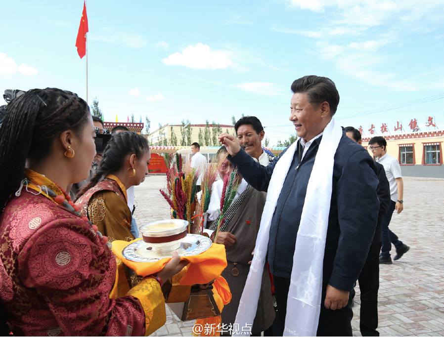
Grant shows us, through Tibetan eyes, how Xi Jinping’s visit looks. Fawning official media made much of Xi’s willingness to walk in the light rain, holding his own umbrella, headlining this as: “Walking in the rain shows concern for locals.”

Xining is decorated with official slogans boosting the China Dream, Xi’s signature project. Grant meets a young Tibetan who says:
“I have many thoughts about this. This was made by the government. We Tibetans live in harmony, but the Han won’t even think of helping others. Our Tibetan religion says a lot about helping and living in harmony.”
A TIBETAN EPISODE IN XI JINPING’S GRAPHIC NOVEL OF THE CHINA DREAM
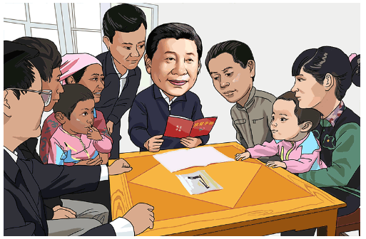
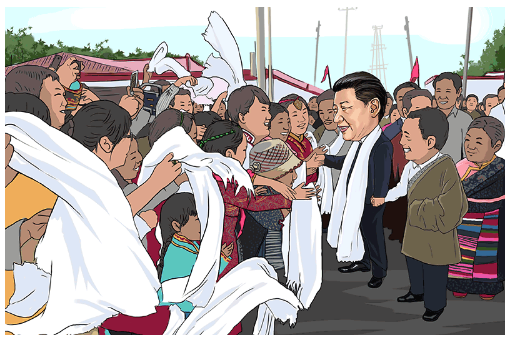
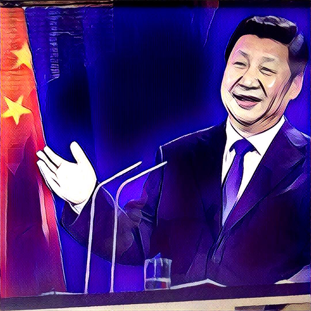
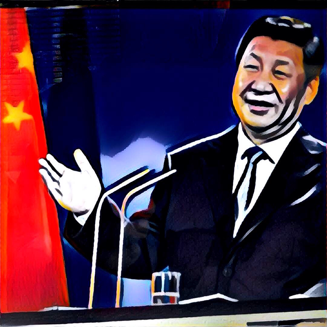
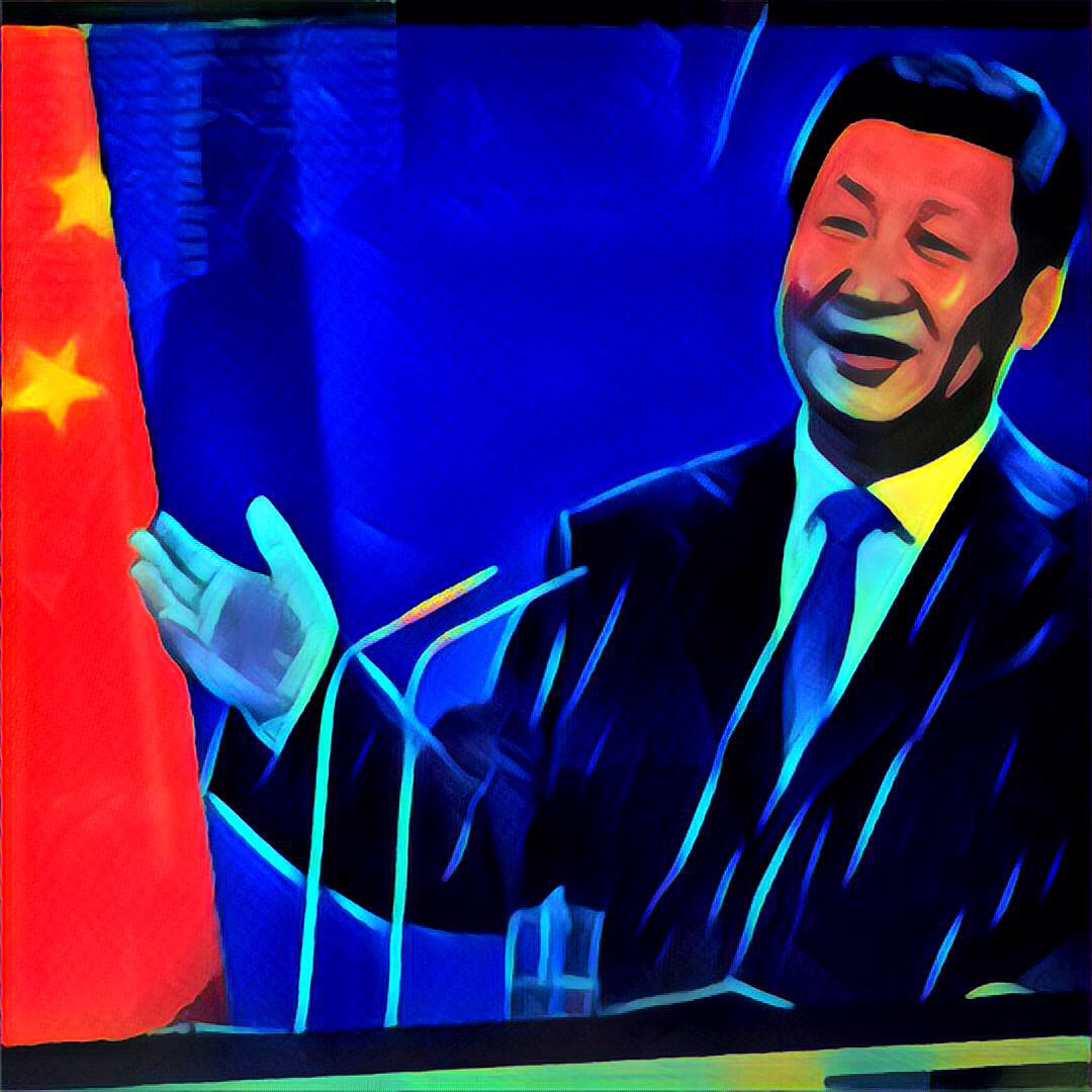
Astute readers will by now have noticed that Xi Jinping, and all who come into contact with him, have turned into cartoon characters. This is not the work of cartoonists who mock, but of official media in China seeking all the better to depict Xi as the benevolent emperor, and master of all under heaven.
In China’s spectacular party-state, ordinary propaganda photos fail to fully convey the drama, or to focus the gaze on what most matters. Simplifying the pic into a toon does the trick, making Xi Jinping a superhero who also smiles and even carries his own umbrella. Official media have increasingly made Xi the lead in the toon version of the China Dream. As Big Daddy Xi rises and rises, no longer just a person, greater even than a “personage” (a favourite trope in revolutionary China for saying some are more equal than others), he becomes an avatar of himself in toon form.
His inspection of Amdo Qinghai becomes an episode in the graphic novel of his assumption of the mandate of heaven. The Tibetans so sharply depicted in the hard lines of a toon play their part properly, submitting to his benevolent blessings, bowing before him and humbly offering khatag silk scarves, properly paying tribute, which the ever-humble Xi receives with a gracious smile. If only real Tibetans in real life knew how to submit, and pay tribute, as well as in the toon versions; then the China Dream would be complete.
Spectacular China, led by its toon superhero, is what “public opinion management” is about. In the West, people think China’s massive investment in controlling the internet is all about censorship and shutting down access to the wider world. But that’s only half the story. The other half is positive manipulation of what the masses think, promoting the good news of China’s rise, and ever expanding successes, the closeness of fulfilling the China Dream. The graphic novel and the toon are ideal for focusing the gaze solely on what matters, sweeping aside all else as clutter.
The next episode of the graphic novel is the gathering in Hangzhou city of the leaders of the 20 most powerful countries, the G-20, 4 & 5 September 2016. Again, the stage is set, as Jane Perlez of the New York Times noted in advance: “’There will not be any policy miracles coming out of the summit,’ said Tristram Sainsbury, project director of G-20 studies at the Lowy Institute for International Policy in Australia. That makes the show itself even more important. ‘For China, first and last it’s about the show, and to show they can organize a major international meeting,’ said Matthew P. Goodman, a G-20 expert at the Center for Strategic and International Studies. The party’s resilience under Mr. Xi — on display with giant flags showing the hammer and sickle at security checkpoints — is part of the meeting’s message. One of Mr. Xi’s provincial successors, the party chief, Xia Baolong, said the meeting would ‘demonstrate the great achievement of China’s opening and reform, and the immense superiority of socialism with Chinese characteristics.’” Stand by for the next ep.
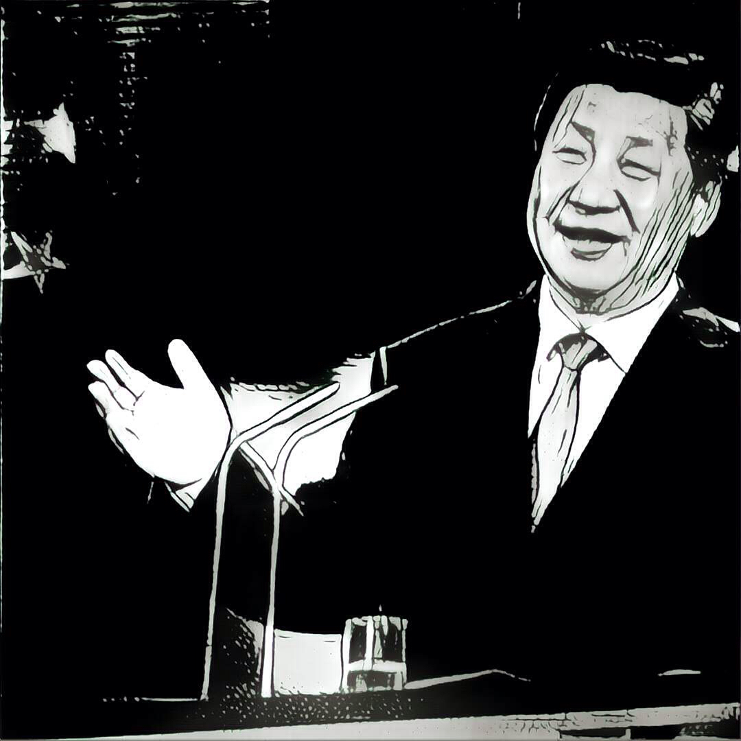
It’s a pity the Tibetans don’t seem to know the script. So here at Rukor, we’ve taken the liberty of inventing a few more cartoon versions of Xi Jinping, using the cool Prisma app, that turns mere photos into art, in the brush stroke style of famous artists. As Andy Warhol might have said: let there be one, two, many Xi Jinpings.


[1] Andrew Nicholas Grant, Belonging and Ethnicity in China’s West: Urbanizing Minorities in Xining City on the Eastern Tibetan Plateau, PhD dissertation, University of California, 2016, 61
[2] Isabelle Côté, Internal migration and the politics of place: a comparative analysis of China and Indonesia, Asian Ethnicity, 2014, Vol. 15, No. 1, 111–129
[3] GREG ROHLF, Reproduction and State-Building along China’s Frontier, China Information, 21 #3, 2007, 425-
[4] Qinghai Statistical Yearbook 2015, table 14-20, Output of major Industrial products by Region
[5] LIU Lin, FENG Wei, CHEN Qing, Uranium Forming Conditions and Exploration Prospect in the Northeast Margin of Qaidamu, Journal Of East China Institute Of Technology Vol. 36 No. 3 Sep. 2013
[6]HUANG Da-you,WANG Si-li,MAO Jian-xun,XU Wei,CHEN
Yu-liang,Liu Zhi-pen, Preliminary Study on the Uranium Source of Zabuye Salt Lake,Tibet, Uranium Geology, 31 #3, May 2015, 389-394
[7]ZHANG Yan,QI Fu-cheng,ZHANG Zi-long,LI Zhi-xing,WANG Wen-quan,YANG Zhi-qiang; Geochemical Characteristics of Hot Water Deposited Siliceous Rock inJiangzha Uranium Deposit, Uranium Geology, 31 #2, March 2015, 81-88
[8] Mechanical Changes in Population in Main Years, table 4-3, Qinghai Statistical Yearbook 2011
[9] Fischer, A.M. (2015). “Subsidizing Tibet: An Interprovincial Comparison of Western China up to the End of the Hu–Wen Administration.” China Quarterly, 1-27.
[10] An Baijie, Xi: Natural resources must be safeguarded, China Daily, August 24, 2016
[11] Wu Hung, Remaking Beijing: Tiananmen Square and the Making of a Political Space, University of Chicago Press, 2005
![[no title] 1972 Andy Warhol 1928-1987 Purchased 1984 http://www.tate.org.uk/art/work/P77076](http://rukor.org/wp-content/uploads/2016/08/Warhol-Mao.jpg)